


Restoring a façade, transforming an interior or simply maintaining a listed building first requires a precise understanding of what one is dealing with. Warped walls, vaults, carved decorations, successive additions: a historic building can rarely be described by old plans alone.
In Switzerland, such work is overseen by the cantonal heritage department, and federal conservation principles require a thorough understanding of the building before any action is taken. Laser scanning is well suited to this task: it measures without contact and records the building exactly as it stands.
Why a listed building requires a specialised survey
What the Swiss framework requires
The protection of built heritage is primarily the responsibility of the cantons. Their departments are responsible for legal measures, inventorying, monitoring works and archiving, as highlighted, for example, by the canton of Neuchâtel. The terminology varies from one canton to another: ‘listed’, ‘placed under protection’, ‘entered in the inventory’. As a general rule, any work on these buildings must be reviewed by the relevant cantonal authority.
The common framework is established at federal level. The Principles for the Conservation of Switzerland’s Built Cultural Heritage, published in 2007 by the Federal Commission for Historic Monuments, set out two rules directly related to the survey. Before any action is taken, a precise understanding of the property must be acquired (Art. 3.5). And every intervention must be accompanied by documentation appropriate to the property and the measures taken (Art. 3.9).
Irregular geometry
An old building almost never has right angles. Walls lean, floors sag, and vaults and roof structures have shifted over time. Decorative features (mouldings, sculptures, murals) add a level of complexity that a tape measure and total station can only partially capture.
Do not damage the structure
The preservation of the building’s fabric takes precedence over all other measures, in accordance with the same federal principles (Art. 3.8). The survey must therefore be carried out without coming into contact with fragile surfaces, without drilling, and by minimising the time spent on site.
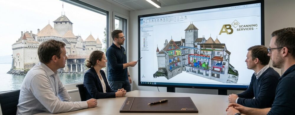
The method: from laser scanning to a usable model
A heritage survey generally combines several techniques, chosen according to the object and the expected deliverables.
- A preliminary site visit identifies sensitive areas, access points, lighting conditions and the parts to be documented in detail.
- The laser scanner, mounted on a tripod, records the geometry of the interior and façades station by station, without coming into contact with the surfaces.
- Photogrammetry complements the scan where colour and texture are important, such as painted decorations or stonework.
- For roofs, bell towers and high façades, a drone can supplement the data capture if the site and flight regulations permit.
- The stations are then aligned with one another and, where necessary, tied to the Swiss coordinate system. An accuracy check validates the entire dataset before the final deliverables are produced.
Site constraints and solutions
Most difficulties are resolved through organisation rather than technology.
- Places of worship, museums and administrative buildings often remain open during the survey. The survey is therefore planned by zones, outside opening hours or service times.
- Gilding, stained-glass windows and very dark or damp stone do not reflect the laser signal well. We adjust the settings, use multiple viewpoints and supplement the data with photogrammetry.
- In attics, bell towers and roof structures, closely spaced stations are required, and access arrangements must be agreed with the owner.
- Federal guidelines also require an interdisciplinary approach (Art. 3.6). The survey is therefore prepared in collaboration with the architect, the restorer and, depending on the canton, the heritage department.
What deliverables are required for a heritage building?
| Deliverable | Main purpose | For whom |
|---|---|---|
| Point cloud | Archived baseline report, dimensioning, comparison over time | Owner, heritage department |
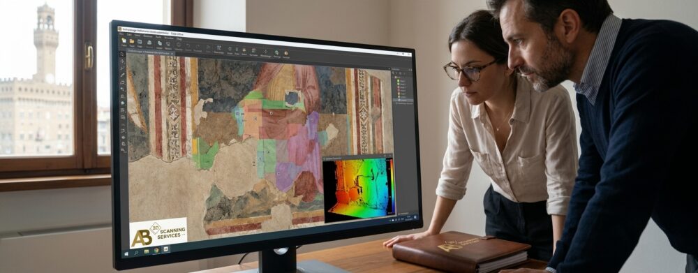
| Orthoimages of façades and ceilings | Stone-by-stone survey, damage mapping, restoration monitoring | Restorers, architects |
| CAD plans, sections and elevations | Planning application, conversion studies | Architects, engineers |
| Heritage BIM model (HBIM) | Coordination of works, maintenance management | Planners, building managers |
| Virtual tour | Remote consultation, public engagement | Owners, institutions |
Defining the right level of detail
A planning application, a restoration of decorative features and archiving do not all require the same level of detail. For a conversion project, precise plans and sections are often sufficient. For a restoration, high-resolution orthophotos become the primary tool. Modelling every moulding only makes sense if a specific purpose justifies it, as every additional level of detail increases processing time.
Preparing the survey: 5 steps
- Contact the cantonal heritage department at an early stage; they can specify the building’s protection status and their documentation requirements.
- Gather the available archive material: old plans, previous surveys, historical studies, photographs. These guide the survey and help to interpret its findings.
- Agree on the deliverables and level of detail with the architect and the restorer, based on the intended use.
- Arrange access and the timetable with the owner and occupants, including for attics, bell towers or cellars.
- Confirm the capture method, ensuring in particular that no markers or fixings are used on fragile surfaces.
After the work: a reference archive
Once archived, the survey provides a baseline record of the building’s condition on a given date. It is then used to:
- compare two survey campaigns to monitor a crack, subsidence or movement of the roof structure
- prepare for future interventions without having to start from scratch
- meet the documentation requirements set out in federal guidelines, which stipulate that a record must be kept of every intervention
- reconstruct a damaged section in the event of a disaster, based on reliable measurements
For an overview of the uses of surveys of historic buildings, see also our article on 3D digitisation of built heritage.
Key points to remember
- In Switzerland, federal conservation principles require a precise understanding of the building prior to any intervention, followed by documentation of each measurement.
- Laser scanning is a non-contact method, which respects the priority given to the conservation of the building’s fabric.
- Scanning, photogrammetry and, where necessary, drone technology are combined depending on the specific project.
- The final deliverable and level of detail depend on the intended use: planning permission, restoration or archiving.
- Prepared in collaboration with the cantonal authority, the architect and the conservator, the survey remains useful for future interventions.
A survey tailored to each monument
AB 3D Scanning supports owners, architects and conservators in documenting listed buildings in Switzerland, from non-contact scanning through to orthoimages, plans and 3D models. If you are planning a restoration or conversion, we can work with you to define the scope and level of detail best suited to your building.
Sources
- Basic documents and principles for the conservation of Switzerland’s built cultural heritage (Federal Commission for Historic Monuments, Federal Office of Culture)
- Code of Ethics for Cultural Heritage (Canton of Neuchâtel)
- Converting a heritage building (Canton of Neuchâtel)