
-
Digital Building Survey
-
3D BIM Models
-
Capture of HVAC installation / MEP Plans
-
As-built plans CAD – 2D , 3D Plans (DWG, Revit, ArchiCad)
We work in:
Geneva Vallais Vaud Neuchâtel
Fribourg Jura Zurich Bern

Our Deliverables
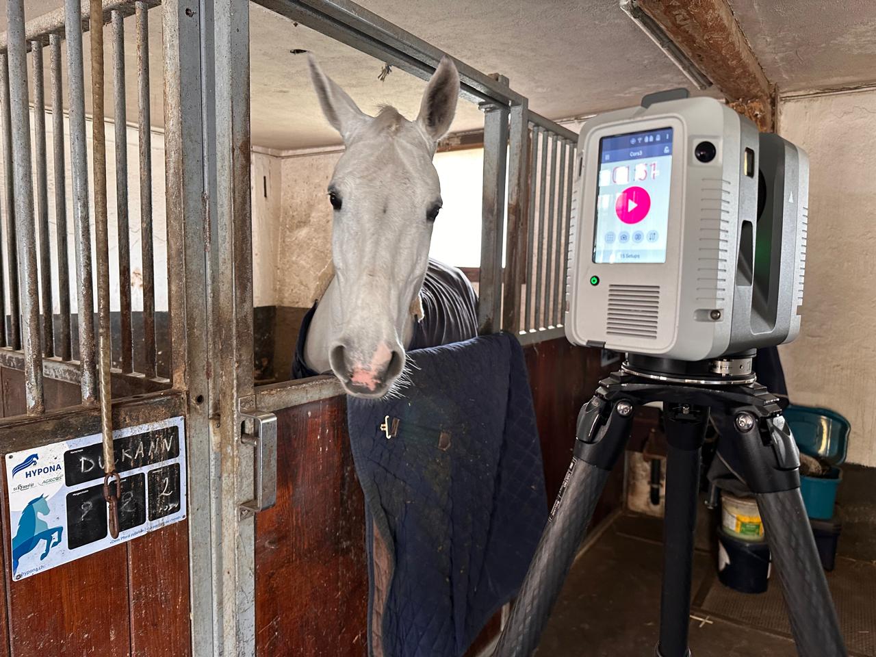
The device (RTC 360 from Leica in our case) using LIDAR technology, captures 2 million points per second at each setup, gradually creating a point cloud of billions of points. Every point practically has coordinates. At the same time, 360° photos are captured to provide color insights.
For a 1,000 m2 building for example, we might need around 200 setups and we expect a point cloud of 2.5 billion points.

Advanced software algorithms, combined with user expertise, transform the point clouds into a precise and well-cleaned 3D model, free of reflections and other unnecessary objects.
Subsequently, depending on the desired deliverables, further software is applied to create: CAD plans (DWG, ArchiCad and REVIT), 3D BIM models, ortho-images, Virtual Reality, visualization of buildings in real time, or even digital twins.
To find out more, check the following sites and video
Benefits of 3D Scanning / how it works Leica explains how 3D Scanning works LIDAR technology in a glance 6 Facts You Need to Know About 3D Reality Capture 3D Laser Scanning and Scan to BIM As Built Laser Scanning Workflow Digital Reality by Hexagon HxDr Lidar in AEC: overcoming obstacles and unlocking opportunitiesRecent Projects
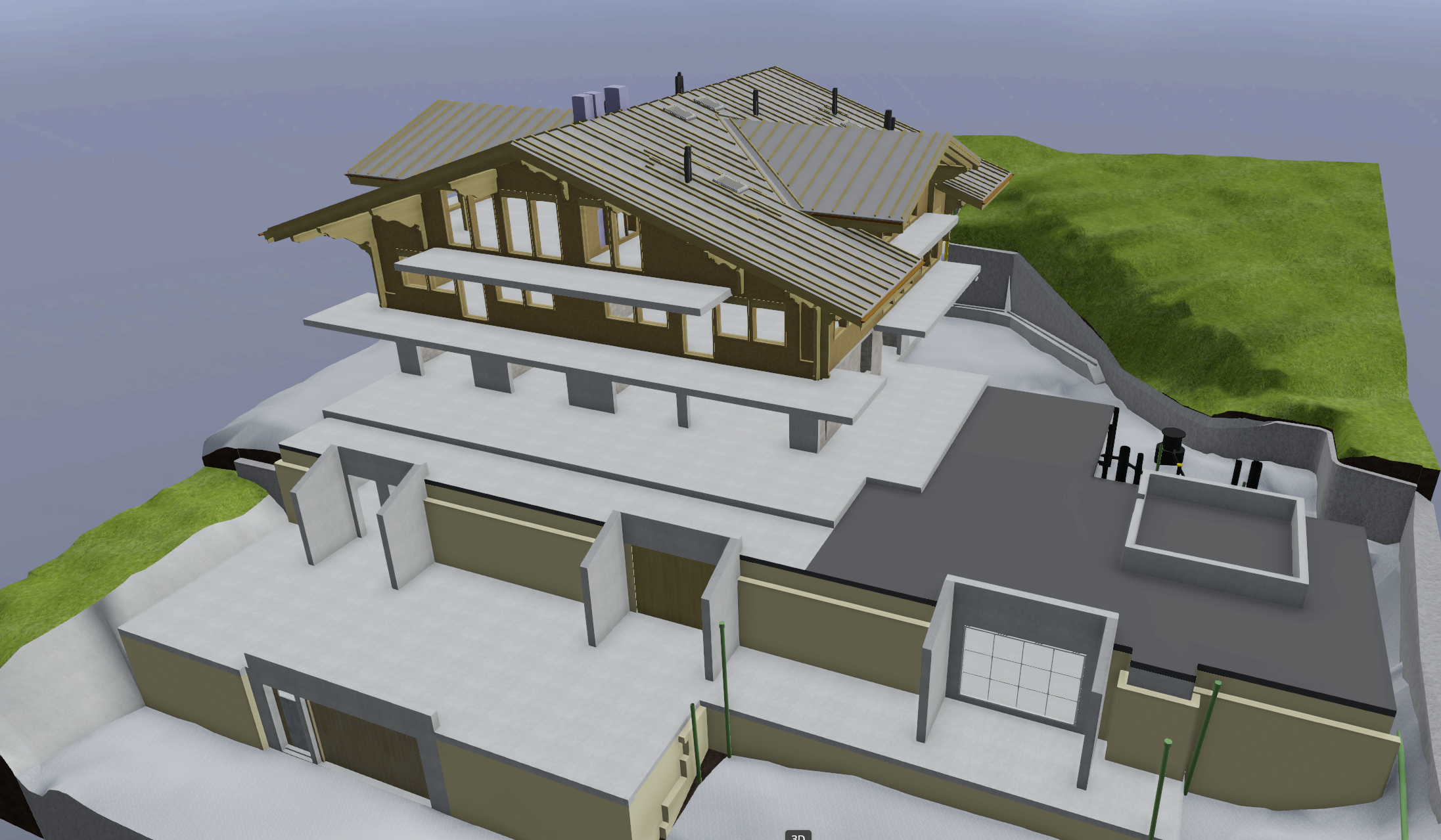
3D Scan of a building under constraction to enhance stakeholders collaboration
3D Scanning Services
Gstaad

3D Scanning and CAD plans of an historical church.
Heritage 3D Scanning
Corfu, Greece
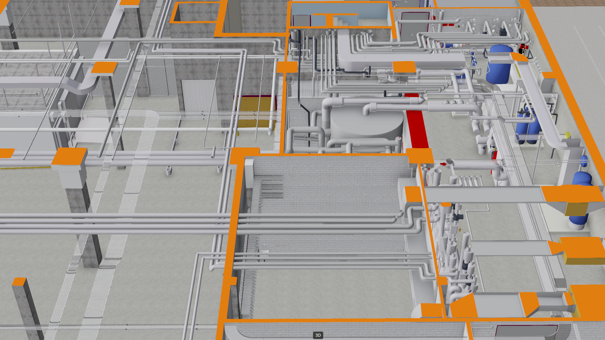
Scan to BIM / 3D REVIT Model Architectural and MEP
MEP – Scan to BIM As-Built
Marin-Epagnier, Neuchâtel